 Geoportale Piemonte
Mobilità - Stazioni ricarica veicoli elettrici - Geo-servizio WMS
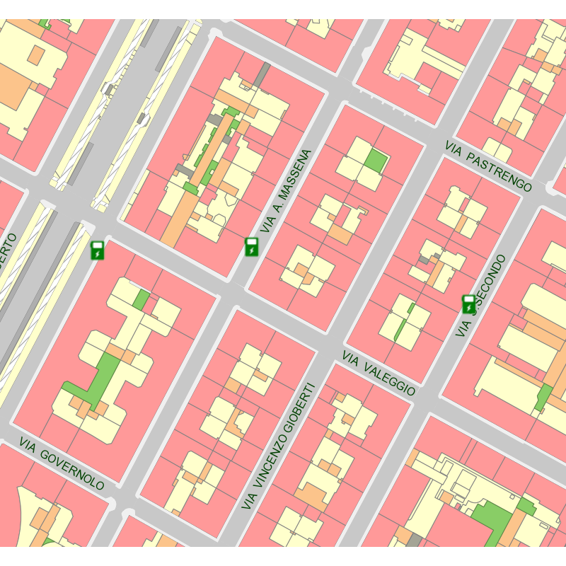
Il Web Map Service permette di visualizzare su mappa le Stazioni di ricarica dei veicoli elettrici e consultare le relative informazioni su operatore, stato (attivo, non attivo), potenza (KW), indirizzo, coordinate.
I geoservizi sono stati realizzati nell'ambito del progetto europeo e-SMART per lo sviluppo della mobilità elettrica nel territorio Alpino ( https://www.alpine-space.eu/).
Si rimanda alla consultazione dei dati collegati per la data di aggiornamento e descrizione dei contenuti.
Simple
Identification info
- Date (Revision)
- 2022-03-31
- Date (Creation)
- 2022-03-31
- Identifier
- c_l219:499894ec-60f8-4ead-ba51-248ee25abe11
- Keywords
-
-
RNDT
-
- Keywords
-
-
EU
-
- Keywords
-
-
trasporti
-
- Keywords
-
-
viabilità
-
-
ISO - 19119 geographic services taxonomy
- Keywords
-
-
colonnine
-
- Keywords
-
-
progetto europeo
-
- Keywords
-
-
e-smart
-
- Access constraints
- otherRestrictions Other restrictions
- Other constraints
- no limitations to public access
- Use constraints
- otherRestrictions Other restrictions
- Other constraints
- Service Type
- view
))
Coupled Resource
- Operation Name
-
GetCapabilities
- Identifier
-
c_l219:f3f62052-2209-45ea-8c15-ec279d950ccc
- Coupling Type
- mixed Mixed
Contains Operations
- Operation Name
-
GetMap
- Distributed Computing Platforms
- WebServices Web services
- Operates On
- Distribution format
-
-
OGC:WMS
(
1.3
)
-
OGC:WMS
(
1.3
)
- OnLine resource
- StazRicarica ( Web Map Service (WMS) )
- Hierarchy level
- service Service
- Other
-
Servizio
Conformance result
- Date (Publication)
- 2009-10-19
- Explanation
-
non conforme
- Pass
- No
Conformance result
- Date (Publication)
- 2010-12-08
- Explanation
-
Fare riferimento alle specifiche indicate
- File identifier
- c_l219:499894ec-60f8-4ead-ba51-248ee25abe11 XML
- Metadata language
- itaItaliano
- Character set
- utf8 UTF8
- Hierarchy level
- service Service
- Hierarchy level name
-
Servizio
- Date stamp
- 2023-04-12
- Metadata standard name
- Linee Guida RNDT
- Metadata standard version
-
2.0
Overviews
Spatial extent
Provided by
