 Geoportale Piemonte
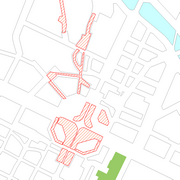
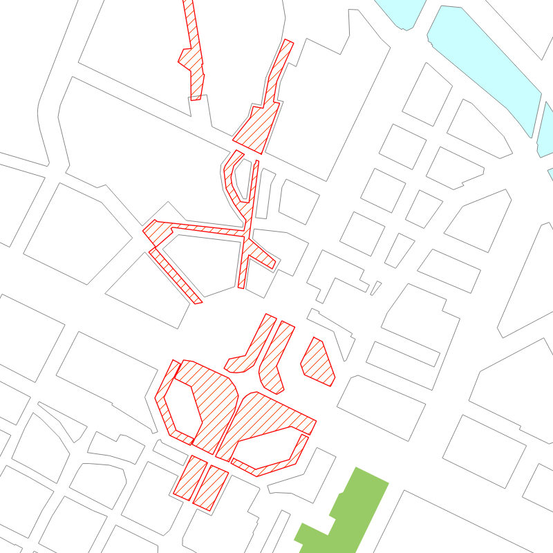
Mercati
Il dataset contiene le informazioni, georiferite sull'area occupata, relative ai mercati rionali che si svolgono nella Città , autorizzati dai settori competenti. Rappresenta la mappa del sistema territoriale di vendita sulle aree mercatali. E' possibile consultare anche l'elenco dei mercati.
Simple
- Date (Revision)
- 2009-09-01
- Date (Creation)
- 2009-09-01
- Identifier
- c_l219:b4e3cf64-7bd1-45df-98cd-633aa4082921
- Presentation form
- mapDigital Digital map
- Issue identification
-
c_l219:b4e3cf64-7bd1-45df-98cd-633aa4082921
- Maintenance and update frequency
- asNeeded As needed
- Keywords
-
-
RNDT
-
- Keywords
-
-
EU
-
- Keywords
-
-
mercati
-
aree
-
- GEMET - Concepts, version 2.4
-
-
commercio
-
- Access constraints
- otherRestrictions Other restrictions
- Other constraints
- no limitations to public access
- Use constraints
- otherRestrictions Other restrictions
- Other constraints
- Spatial representation type
- vector Vector
- Denominator
- 1000
- Metadata language
- itaItaliano
- Character set
- utf8 UTF8
- Topic category
-
- Economy
))
Vertical extent
- Minimum value
- NaN
- Maximum value
- NaN
- Unique resource identifier
- Monte-Mario-Italy1
- Distribution format
-
-
ESRI Shapefile
(
N.A.
)
-
CSV
(
N.A.
)
-
ESRI Shapefile
(
N.A.
)
- OnLine resource
- accessPoint ( Web Feature Service (WFS) )
- OnLine resource
- MercatiAree ( Web Map Service (WMS) )
- OnLine resource
- accessPoint ( WWW:DOWNLOAD-1.0-http--download )
- OnLine resource
- accessPoint ( WWW:DOWNLOAD-1.0-http--download )
- OnLine resource
- Scheda Elenco dei Mercati ( WWW:LINK-1.0-http--link )
- Hierarchy level
- dataset Dataset
Quantitative result
- Value
- 0.4
Conformance result
- Date (Publication)
- 2010-12-08
- Explanation
-
Fare riferimento alle specifiche indicate
- Statement
-
rilievi delle occupazioni dei posteggi sulle aree mercatali della Città, ì come istituite, riprogettate e assegnate agli operatori, secondo quanto definito dai settori competenti (Divisione Commercio e Settore Infrastrutture per il Commercio)
- File identifier
- c_l219:b4e3cf64-7bd1-45df-98cd-633aa4082921 XML
- Metadata language
- itaItaliano
- Character set
- utf8 UTF8
- Hierarchy level
- dataset Dataset
- Date stamp
- 2025-03-26
- Metadata standard name
- Linee Guida RNDT
- Metadata standard version
-
2.0
Overviews
Spatial extent
Provided by
