 Geoportale Piemonte
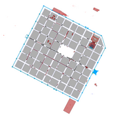
Carta archeologica
I dati relativi alla Carta Archeologica georiferita della Città di Torino, sono frutto della collaborazione tra Città di Torino e la Soprintendenza per i Beni Archeologici del Piemonte e del Museo Antichità Egizie nell'ambito di un Protocollo d'intesa tra i due Enti che prevede l'impegno reciproco all'aggiornamento costante e periodico dei dati e alla pubblicazione nel mapservices, mantendendo il più possibile lo stretto collegamento con MuseoTorino e con le sue schede di approfondimento per i singoli ritrovamenti.
Simple
- Date (Revision)
- 2013-08-01
- Date (Creation)
- 2013-08-01
- Identifier
- c_l219:de583783-0224-46cd-90ca-7fa6abe4e7e3
- Presentation form
- mapDigital Digital map
- Issue identification
-
c_l219:de583783-0224-46cd-90ca-7fa6abe4e7e3
- Maintenance and update frequency
- asNeeded As needed
- Keywords
-
-
RNDT
-
- Keywords
-
-
EU
-
- Keywords
-
-
piani
-
archeologica
-
- Keywords
-
-
scavi
-
- Access constraints
- otherRestrictions Other restrictions
- Other constraints
- no limitations to public access
- Use constraints
- otherRestrictions Other restrictions
- Other constraints
- Spatial representation type
- vector Vector
- Denominator
- 1000
- Metadata language
- itaItaliano
- Character set
- utf8 UTF8
- Topic category
-
- Planning cadastre
N
S
E
W
))
Vertical extent
- Minimum value
- NaN
- Maximum value
- NaN
- Unique resource identifier
- Monte-Mario-Italy1
- Distribution format
-
-
ESRI Shapefile
(
1.0
)
-
ESRI Shapefile
(
1.0
)
- OnLine resource
- accessPoint ( Web Map Service (WMS) )
- Hierarchy level
- dataset Dataset
Quantitative result
- Value
- 0.4
Conformance result
- Date (Publication)
- 2010-12-08
- Explanation
-
Fare riferimento alle specifiche indicate
- Statement
-
non presente
- File identifier
- c_l219:de583783-0224-46cd-90ca-7fa6abe4e7e3 XML
- Metadata language
- itaItaliano
- Character set
- utf8 UTF8
- Hierarchy level
- dataset Dataset
- Date stamp
- 2021-01-15
- Metadata standard name
- Linee Guida RNDT
- Metadata standard version
-
2.0
Overviews
thumbnail

large_thumbnail
Spatial extent
N
S
E
W
Provided by

Associated resources
Not available