 Geoportale Piemonte
Unita' insediative - Geo-servizio WMS
Il Web Map Service permette di visualizzare le informazioni areali urbanizzate/antropizzate dell'intero territorio comunale, che hanno una destinazione d'uso coerente al loro interno e che afferiscono a una data proprieta'
Si rimanda alla consultazione dei dati collegati per la data di aggiornamento e descrizione dei contenuti.
Simple
Identification info
- Date (Revision)
- 2023-10-31
- Date (Creation)
- 2023-10-31
- Identifier
- c_l219:b4c2fc92-d443-4108-a454-e79a14e422ac
- Keywords
-
-
RNDT
-
- Keywords
-
-
EU
-
-
ISO - 19119 geographic services taxonomy
- Keywords
-
-
uso
-
-
GEMET- Concepts version 2.4
-
-
uso del territorio
-
- Keywords
-
-
destinazione
-
- Keywords
-
-
carta tecnica
-
- Keywords
-
-
aree
-
- Access constraints
- otherRestrictions Other restrictions
- Other constraints
- no limitations to public access
- Use constraints
- otherRestrictions Other restrictions
- Other constraints
- Service Type
- view
N
S
E
W
))
Coupled Resource
- Operation Name
-
GetCapabilities
- Identifier
-
c_l219:44723bac-34a1-41ce-af72-760a404bf22f
- Coupling Type
- mixed Mixed
Contains Operations
- Operation Name
-
GetMap
- Distributed Computing Platforms
- WebServices Web services
- Operates On
- Distribution format
-
-
OGC:WMS
(
1.3
)
-
OGC:WMS
(
1.3
)
- OnLine resource
- accessPoint ( Web Map Service (WMS) )
- Hierarchy level
- service Service
- Other
-
Servizio
Conformance result
- Date (Publication)
- 2009-10-19
- Explanation
-
non conforme
- Pass
- No
Conformance result
- Date (Publication)
- 2010-12-08
- Explanation
-
Fare riferimento alle specifiche indicate
- File identifier
- c_l219:b4c2fc92-d443-4108-a454-e79a14e422ac XML
- Metadata language
- itaItaliano
- Character set
- utf8 UTF8
- Hierarchy level
- service Service
- Hierarchy level name
-
Servizio
- Date stamp
- 2024-02-23
- Metadata standard name
- Linee Guida RNDT
- Metadata standard version
-
2.0
Overviews
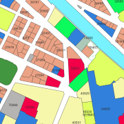
thumbnail

large_thumbnail
Spatial extent
N
S
E
W
Provided by

Associated resources
Not available